

Four months before a massive ice-rock avalanche and glacial collapse triggered devastating flash floods in Nepal, killing more than 700 people, the International Centre for Integrated Mountain Development (ICIMOD) had issued a stark warning: snow cover across the Hindu Kush Himalaya (HKH) had fallen 27.8% below the long-term average, the lowest level in more than two decades.
The disaster along the Bhote Koshi and Lhende Khola river valleys was a high-velocity cascading event involving ice, rock and water. While no single factor can explain such a complex disaster, climate change is making the Himalayan system more vulnerable to hazards. The Hindu Kush Himalaya region holds the largest volume of ice and snow outside of the North and South Poles.
Lesser the snow, faster the glacier melt
Dr Thamban Meloth, Director of the National Centre for Polar and Ocean Research (NCPOR), Ministry of Earth Sciences, Government of India, told Onmanorama that declining snow cover, glacier retreat and thawing permafrost are among the factors altering the stability of the high mountains.
“Snow acts as a protective layer over glaciers and regulates the timing of melt. Normally, glacier melt begins after the snow cover melts in spring, around March, April and May. When there is insufficient snow, glaciers can begin melting earlier. Snow drought has been happening quite frequently of late,” says Dr Thamban.
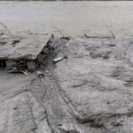
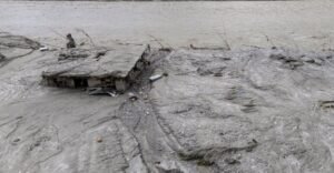
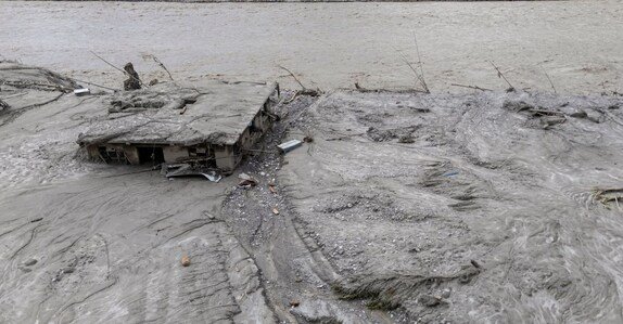
A house that was completely submerged in flood waters. Photo: PTI
Large parts of the upper Himalayas, particularly above 5,000 metres, contain permafrost, or ground that remains frozen for extended periods. As temperatures rise and snow cover declines, this frozen ground can thaw. Himalayan permafrost contains frozen sediments, boulders and other loose material held together by frozen water. When it thaws, the terrain can become unstable.
“When permafrost thawing happens, they become loose rock, gravel and soil material,” Dr Thamban added.
This can increase the risk of slope failures, rockfalls and landslides. At elevations of 5,000-6,000 metres, falling material can acquire enormous gravitational energy.
“When an avalanche or landslide happens, this gravitational energy makes it extremely devastating. You get a mixture of ice, rocks, water and everything else. It is like wet concrete, and its ability to carry things is much greater,” he said.
In 2023, the United Nations said Nepal had lost close to one-third of its ice in just over 30 years, while its glaciers were melting 65% faster in the previous decade than in the one before it. The decline has implications not only for glaciers but also for water security, agriculture, hydropower and downstream communities dependent on the region’s river systems.
Dr Roxy Mathew Koll, Climate Scientist at the Indian Institute of Tropical Meteorology and IPCC lead author, says in the Himalayas, the sustained rise in temperature and the growing number of days close to or above freezing have an impact.
“Even modest warming at these elevations can lift the snowline, lengthen the melting season, turn snowfall into rain, thin glaciers and thaw the frozen ground that binds fractured rock together. A preliminary analysis by climate scientists indicates summer warming of about 0.29°C per decade near Langtang Lirung since 1940. That adds up to roughly 2.5°C over the period. Warming is changing the stability of entire mountain slopes and increasing the risk of rock-ice avalanches, landslides and sudden floods,” he said.
July 2026 was the second-warmest July in both the global and local temperature records. This exceptional warmth could have accelerated melting and weakened the bonds between ice and rock, he added.
Though the fingerprints of global warming are clear in such events, Dr Koll says it’s too early to attribute this particular collapse to climate change, since that requires detailed investigation.
“The heatwaves and flood lines of past decades may not represent those of the coming decades. We therefore need to disaster-proof villages in fragile mountain environments against the conditions they are likely to face under further warming,” he said.
No one-size-fits-all warning system
According to Dr Thamban, there is no one-size-fits-all early warning system for the Himalayas. The trigger can vary from extreme rainfall and landslides to the failure of the moraine debris that forms a glacial lake’s natural dam.
“There are three broad reasons for such events: the long-term changes driven by climate change; localised geological and extreme weather conditions; and human activity, including changes in land use and infrastructure. The localised effects can be much stronger in the Himalayas because there are many narrow valleys, each with its own microclimate. What you saw this time in Nepal was not what you found in Sikkim when we had a glacial lake outburst,” he said.
Most prediction models operate at grid sizes of around 10 sq km or more, while an extreme event can occur within an area of less than 1 sq km.
“Many of the existing models do not really work for these events in the mountains, especially due to the extreme topographical variability. That is a big challenge,” he said.
The Ministry of Earth Sciences’ Mission Mausam is working on improved and high resolution AI-based models and expanded automated observations. But collecting data in the high Himalayas is itself difficult. Some glacial lakes are located around 5,000 metres and can take days of trekking to reach and establish observation systems that also require uninterrupted power supply.
“We simply don’t have enough instruments across all these areas. Without enough data coming in, our models can go wrong. Our model predictions are only as good as the data you feed into it,” Dr Thamban said.
Better monitoring, higher-resolution models and stronger coordination between scientific and disaster-management agencies are needed. Since many glacier basins and rivers are transboundary in nature, countries also need to quickly share data and coordinate warning systems.
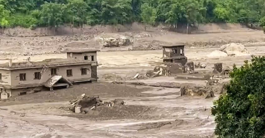
Muddy floodwater gushes through a residential settlement after a sudden flash flood in the Bhotekoshi river, in Nuwakot, Bagmati Province, Nepal. Photo: PTI
Planning for an unstable mountain environment
The changing conditions also need to be factored into infrastructure and land-use planning. Permafrost and ground-warming assessments should form part of Detailed Project Reports for infrastructure projects in high-altitude areas. Tourism and settlements have also expanded into previously less-occupied areas, increasing burden on the land and exposure to hazards. The rapid expansion of infrastructure and hydropower projects across the entire Hindu Kush Himalayas adds another layer of vulnerability.
Communities, meanwhile, need localised standard operating procedures (SOPs) for emergencies. Warning times can be extremely short, less than 3o minutes, and people need to know where to move when an alert is issued.
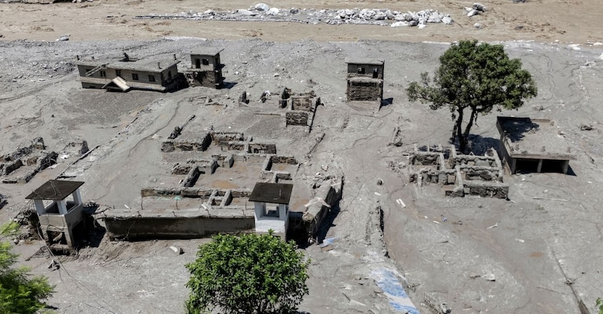
A drone view of the Dhunge Bazar area after flash floods, in Nuwakot, Nepal. Photo: PTI
During a flood threat, for instance, people should move away from river channels and towards higher ground rather than running alongside the river, Dr Thamban said.
Who bears the cost?
Nepal contributes around 0.1% of global greenhouse gas emissions but is highly exposed to climate risks, including floods, landslides and glacial lake outburst floods.
Dr Thamban said the issue of equitable responsibility has been debated for years, but there is still no adequate mechanism to compensate vulnerable countries for the impacts they face.
“It is true that it is not equitable. We are basically suffering because of the compounded effect of global warming due to the human impact. Developing countries like Nepal, India and Bhutan are now bearing the brunt,” he said.
For the Himalayas, he sees no immediate, universal solution.
“The Paris Agreement is not functional, with some major economies are saying that they don’t believe in climate change. Many are not giving enough fund for climate change mitigation. And nobody puts money into some of these developing and highly vulnerable countries that are facing the impacts today. It is now up to UN agencies like WMO, and regional consortium of affected countries to come together and start finding ways and means to find early warning solutions or at least mitigate what is happening around them,” he said.